

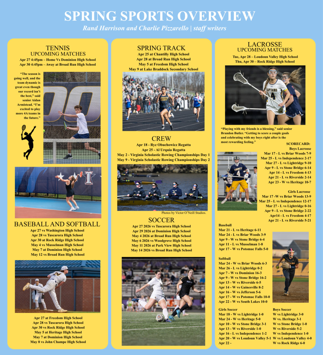


LATIN CLASSES MAP ANCIENT ROMAN WORLD ON CLASSROOM FLOOR
Earlier this year, Latin Teacher Lynn Krepich unveiled a plan to her students to create a map of the ancient roman world on the classroom’s floor. “I got the idea from watching Peter Jennings on ABC,” Krepich said. Jennings would walk over a map in the studio whenever he was reporting on something overseas. “It really puts you there and gets you more interested in the news and what he was reporting on,“ Krepich said.
Krepich asked for the map to be made in order to help her students understand more about what they’re reading and learning about in class. “I think it makes a lot more sense if students know, well, where is Tuscany?” Krepich said when giving an example about a Latin 4 Class. Krepich also feels it would be good for students to know where certain words or phrases derive from when translating authentic Latin.
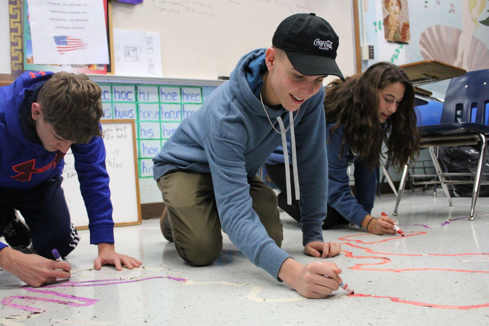
To create the map, she assigned junior Jackson Chinn as map designer and leader of the project. Chinn has lots of experience in cartography, so him leading the project worked out well. “I used to make maps when I was little, which is a little unorthodox for somebody to do in their spare time when they’re in elementary school,” Chinn said.
The boundaries, territories, and geography has been outlined using masking tape, with the map covering the entire floor of the classroom. Soon, the masking tape will be painted with different colors representing different land masses. Chinn has already placed the grid of masking tape on the floor of the classroom, made up of 70 by 70 centimeter boxes each representing a 500 by 500 kilometer area. Krepich expects the map to be completed by the first quarter, so that it is able to be used year round.
The map will start off with basic labels, but Krepich and Chinn are leaving it up to the students to help create labels and icons for specific areas on the map. “It’s all going to be based on what they study from the Latin perspective,” Krepich said. Krepich plans to tie this into the curriculum as well, having the icons students create relate to the unit they’re studying. “Latin 2 is currently studying the Seven Wonders of the Ancient World, so they could create icons for those areas and place them on the map,” Krepich said.
Krepich hopes students are able to make more connections to Latin through this project. “It is essential that every Latin student understands not only the syntax of the text but also the geography that frames the ancient writing and the roman authors,” Krepich said.
“I love how now that we’re translating, that we’re able to go in more depth and actually see where Caesar travelled during the Gallic Wars,” Latin 6 Student Christina Kendrat said.
Your donation will support the student journalists of Loudoun County High School. Your contribution will allow us to purchase equipment and continue to print our issues for the students at our school.